


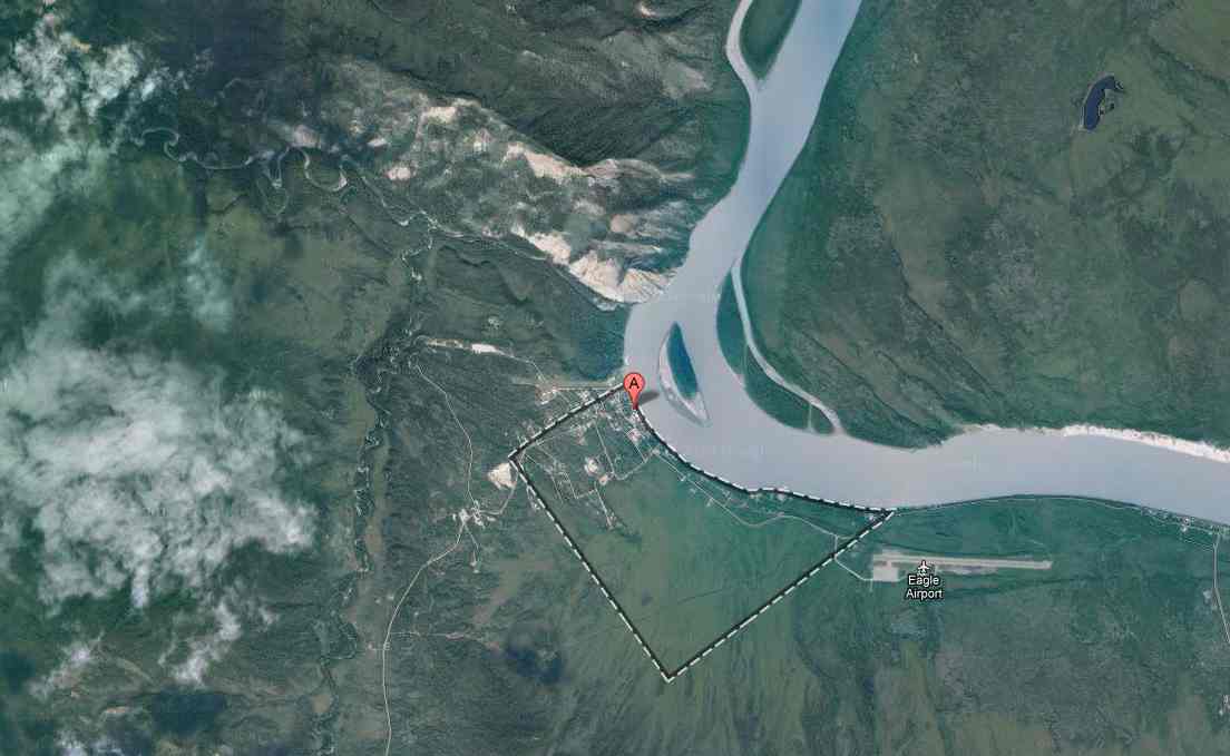
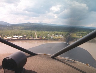
Village Name: Eagle
(Part of the I AM Radio Network)
Status: Installed 05/11/07
Location Description: The City of Eagle and Eagle Village are located on the Taylor Highway, 6 miles west of the Alaska-Canadian border. Eagle is on the left bank of the Yukon River at the mouth of Mission Creek. The Yukon-Charley Rivers National Preserve is northwest of the area. The community lies at approximately 64.788060° North Latitude and -141.200000° (West) Longitude. The area encompasses 1.0 sq. miles of land and 0.0 sq. miles of water.
Climate: Interior Alaska experiences seasonal temperature extremes. January temperatures average -22 to -2, but can range as low as -60; July temperatures average 50 to 72. Average annual precipitation is 11.3 inches. Ice fog occurs during long cold spells.
|
|
Transportation: Roads: -Taylor and Top of the World Highways Winter Trails: Runway: -State-owned 3,600' long by 75' wide Barge:
Closest Major River: Yukon River |
Demographics: The population of the community consists of 7% Alaska Native or part Native. The adjacent Eagle Village is home to about 25 Natives. Subsistence activities are a part of the lifestyle. During the 2000 U.S. Census, total housing units numbered 137, and vacant housing units numbered 79. Vacant housing units used only seasonally numbered 48. U.S. Census data for Year 2000 showed 48 residents as employed. The unemployment rate at that time was 14.29 percent, although 50 percent of all adults were not in the work force. The median household income was $36,042, per capita income was $20,221, and 16.53 percent of residents were living below the poverty level.
Power Source: Alaska Power Company
Local Government Offices: City of Eagle, P.O. Box 1901, 99738, 547-2282
|
Translator Funding Status: Equipment: Monthly Power: Monthly Satellite Fee: |
|
Village Website: None
This information was copied from: http://www.dced.state.ak.us/dca/commdb/CF_CIS.htm