


Village Name: Prudhoe Bay
(Part of the I AM Radio Network)
Status: Installed 06/14/07
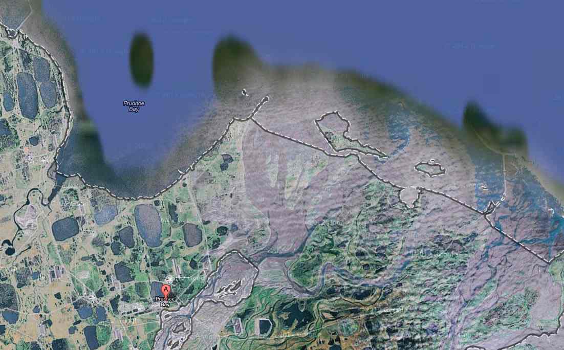
Location Description: Prudhoe Bay lies offshore in the Beaufort Sea, east of Nuiqsut, in the northern waters of Alaska. The community lies at approximately 70.255280° North Latitude and -148.337220° (West) Longitude. (Sec. 08, T010N, R015E, Umiat Meridian.) Prudhoe Bay is located in the Barrow Recording District. The area encompasses 416.3 sq. miles of land and 141.8 sq. miles of water.
Climate: The climate of the North Slope is arctic. Temperatures range from -56 to 78. Precipitation is light, averaging 5 inches, with snowfall of 20 inches.
|
|
Transportation Roads: -Dalton Highway Winter Trails: Runway: -Deadhorse is 6'500' long by 150' wide, ARCO gravel strip is 5,000' by 100' Barge:
Closest Major River: Beaufort Sea |
Demographics: The population of the community consists of 80% Alaska Native or part Native. As a work site, oil is the focus of the local culture. All residents are employees of oil drilling or oil-support companies, and work long consecutive shifts. Living quarters and food are provided to the workforce, and there are a number of recreational facilities. During the 2000 U.S. Census, total housing units numbered 1, and vacant housing units numbered 0. U.S. Census data for Year 2000 showed 2 residents as employed. The unemployment rate at that time was 0 percent, although 33.33 percent of all adults were not in the work force. The median household income was $90,957, per capita income was $19,880, and 0 percent of residents were living below the poverty level.
Power Source: TDX Power
Local Government Offices: None
|
Translator Funding Status: Equipment: Monthly Power: Monthly Satellite Fee: |
|
Village Website: None
This information was copied from: http://www.dced.state.ak.us/dca/commdb/CF_CIS.htm