


Village Name: Hooper Bay
(Part of the I AM Radio Network)
Translator Status: The translator station in this village, K232DS, was initially installed on July 24th, 2007. In August of 2013 the station was converted to carry the broadcast of KYKD, Bethel, a station much more geographically and culturally linked to this community than KIAM in the interior of the state, the primary station for most of the rest of the network. Unlike most other I-AM network translator stations which are fed via satellite, K232DS is now fed the KYKD audio stream via high speed internet from Bethel. This allowed Hooper Bay to become the first of several regional translator sites associated with KYKD.
Location: Hooper Bay is located 20 miles south of Cape Romanzof, 25 miles south of Scammon Bay in the Yukon-Kuskokwim Delta. The city is separated into two sections: a heavily built-up townsite located on gently rolling hills, and a newer section in the lowlands. Hooper Bay is located 500 miles west of Anchorage and about 150 miles west-northwest of Bethel. The community lies at approximately 61.5° North Latitude and 166.1° West Longitude. The official area of the village encompasses 8.7 sq. miles of land and 0.1 sq. miles of water. Hooper Bay is one of the most westerly villages on the mainland of Alaska. Thus K232DS is one of the most westerly radio stations on the continent. Worldwide, only a handful of stations are any farther west.

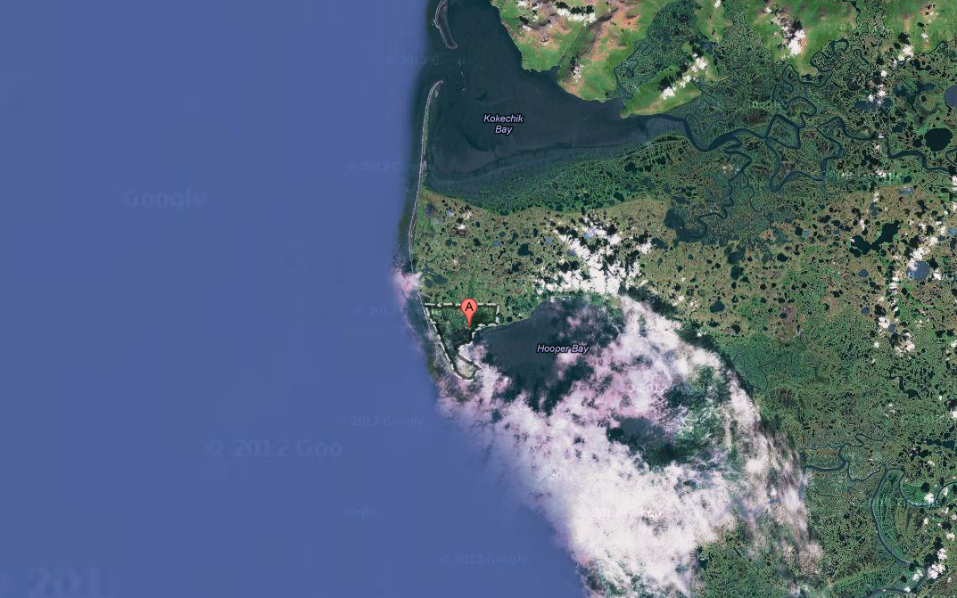
Click on the Google image on the right to link to a Google Maps web page for Hooper Bay.
Climate: The climate in Hooper Bay is maritime. The mean annual snowfall is 75 inches, with a total precipitation of 16 inches. Temperatures range between -25 and 79°F. Winter ice pack and winds often promote severe conditions. The Bering Sea is ice-free from late June through October.
History: The early Yup'ik Eskimo name for the village was ""Askinuk" or "Askinaghamiut." The village was first listed in U.S. government records in 1878 by E.W. Nelson of the U.S. Signal Service. The census data from 1890 lists a total of 138 persons living in 14 homes. The name Hooper Bay came into common usage after a post office with this name was established in 1934. The current Yup'ik Eskimo name for the village is "Naparagamiut" meaning "stake village people." The city government was incorporated in 1966.
One of the most significant events of recent history was a disasterous fire on August 3, 2006. Before it was extinguished, that fire destroyed approximately fifteen acres of the village and some thirty-five structures, including twelve homes, an elementary school, a middle school, a high school, a teacher housing complex, stores, offices and storage shelters. The fire left 70 people homeless, most of whom stayed in Hooper Bay with friends and family until replacement housing was available. The people of the village quickly began the work of recovering from the disaster and received a remarkable amount of help from individuals, agencies, and organizations across the state and the nation. A new school was under construction at the time of the blaze. Work was accellerated and the school opened in December, only some four months after the blaze. Foremost among private organizations who participated in the recovery, Samaritan's Purse went to Hooper Bay shortly after the fire and built several homes for families. The local Evangelical Covenant church donated snowmobiles to families who had lost their vehicles in the fire. Rather than destroying the cohesion and spirit of community within the village, the fire seems to have enhanced the sense of unity, made the rest of the state more aware of the village, and precipitated a flurry of investment in the upgrade, expansion, and modernization of facilities within the community.
Culture: Hooper Bay is a large traditional Yup'ik Eskimo community. Commercial fishing and subsistence activities are the primary means of support. Members of the Village of Paimiut also live in Hooper Bay. A 1,352 square foot Youth and Elder Cultural Center was completed during the summer of 2006; the center provides an area for teaching crafts, marketing, gatherings, and language. The facility is used to teach traditional and cultural activities such as subsistence living and survival to the younger generation. The sale or importation of alcohol is banned in the village.
| Population by Race | Value | Percent |
|---|---|---|
| White | 21 | 1.92 % |
| American Indian and Alaska Native Alone | 1,034 | 94.60 % |
| Black or African American | 0 | 0.00 % |
| Asian alone | 0 | 0.00 % |
| Pacific Islander alone | 0 | 0.00 % |
| Other alone | 1 | 0.09 % |
| Two or More Races | 37 | 3.39 % |
| Housing Units | Value |
|---|---|
| Total Housing Units | 283 |
| Occupied Housing (Households) | 256 |
| Vacant Housing | 27 |
| Vacant Due to Seasonal Use | 1 |
| Owner-Occupied Housing | 190 |
| Renter-Occupied Housing | 66 |
| Households | Value |
|---|---|
| Total Households | 256 |
| Average Household Size | 5 |
| Family Households | 212 |
| Non-Family Households | 44 |
| Pop. Living in Households | 1,093 |
| Pop. Living in Group Quarters | 0 |
Power Source: Alaska Village Electic Cooperative (AVEC) including three large wind turbines at the east side of the village.
Cost of Gasoline: $6.95 per gallon as of July 2014
Some information on this page has been copied from the State of Alaska Community Database where additional information is available.
If you wish to help financially with the construction and operation of K232DS or other KYKD translator stations, you may send a donation to Voice for Christ Ministries, P.O. Box 474, Nenana, AK 99760, or to give via credit card or PayPal use this button:
Photos of Hooper Bay:
|
: |
|
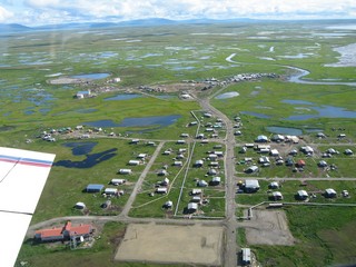
Looking east from over the airstrip about 2008. The translator station is located in the building on the left with the blue roof.
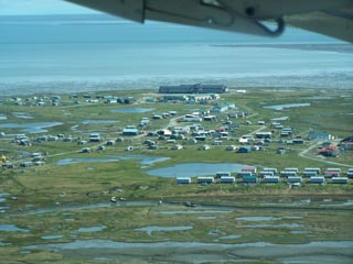
Looking west across the village with the Bering Sea in the background.
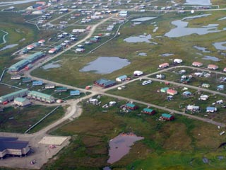
Looking northwest over the western portion of the village. The Covenant Church and teen center is the building just above the intersection in the center of the photo.
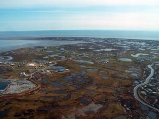
Looking south over the western part of the village to Hooper Bay and the Bering Sea. The large building near the shore is the high school.